Display information
Display indications
The top line shows:
Time / distance to destination / arrival time or travel time / outside air temperature.
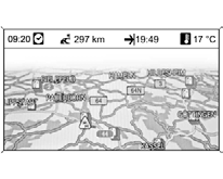
The menu name is shown in the top line.
On the map, the route is shown as a road section highlighted in blue.
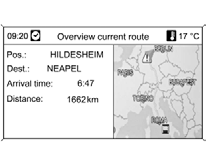
The starting point is shown as a red triangle, the destination as a checkered flag.
Symbols on the road section indicate traffic status information, as well as general information and points of interest.
Symbol overview.
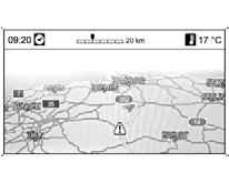
Map scale
The map scale on the navigation display is changed by turning the MENU knob.
The map scale is shown in the top line of the display.
When a scale of 20 km or greater is selected, the map image automatically changes to compass orientation (North up).
Test yourself
A quick Chevrolet Cruze quiz: every answer comes with an explanation and a link to the manual page.